 Moshi, Tanzania
 +255 742 596 234
 generoustours@gmail.com





About 6 Days Rongai route Kilimanjaro
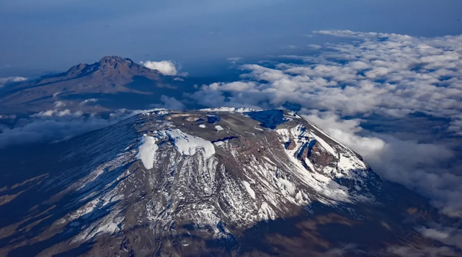
6 Days Rongai route Kilimanjaro Kilimanjaro Climbing Package is a well-designed package which offer a unique and less crowded experience on Mount Kilimanjaro, the African’s highest mountain however it may not necessarily be considered the best option for everyone. The Rongai route is a popular choice for climbers seeking a quieter and more scenic experience on Mount Kilimanjaro. When considering Kilimanjaro climbing package that include the Rongai route, it is important to be in a good physical shape to ensure a safe and enjoyable expedition. It is recommended to thoroughly research and consider various factors before choosing a climbing route, including personal preferences, fitness level, and the desired experience on the mountain. 6 Days Rongai route Kilimanjaro Kilimanjaro climbing typically include a range of services and amenities to ensure a successful and enjoyable climb. The items that are typically included in 6 Days Rongai route Kilimanjaro climbing are; Guided climb, Camping equipment, Meals, Porters, Transportation, First Aid, Oxygen, Climb itineraries and Farewell Dinner.
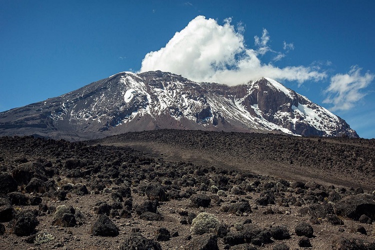
Rongai route is located on the northern side of Mount Kilimanjaro with a variety of spectacular landscapes together with different plants and animal’s species. The typical duration for this trip is 6 Days. The 6 Days Rongai route Kilimanjaro hiking starts on the north side of the Mountain just south of the Kenyan border and is one of the least traveled routes. The route merges with the Marangu Route for the summit climb. The descend follows the Marangu Route on the mountain’s southeast side. The 6 Days Rongai route Kilimanjaro itinerary is described down below.
Upon your arrival at Kilimanjaro International Airport (KIA), our friendly staff will warmly welcome you to Tanzania. You will be transferred to your accommodation in Arusha, where you can rest and prepare for the adventure ahead. Take this time to meet your fellow travelers and discuss the exciting itinerary awaiting you. Get ready to embark on an unforgettable journey into the heart of Tanzania's wilderness.
Elevation: 1387/915 m to 1950 m to 2750 m Distance: 7 KM Hiking Time: 3 hours Habitat: Montana Forest You will have an early breakfast in your hotel. Transfer by our vehicles through many villages and coffee plantations for 2–3-hour drive to Rongai. After signing in and preparing the porters, you will start 6 day-Rongai hiking on a wide path winding through fields of maize and potatoes, and then enter into Montana forest. You will then start to hike gently but consistently through attractive forest that shelters a variety of wildlife. The forest begins to thin as you arrive at Simba Camp with fantastic views over the Kenyan plains. Meals: Breakfast ,Lunch and Dinner
Elevation: 2750 m to 3600 m Distance: 11 KM Hiking Time: 6 hours Habitat: Moorland After an early breakfast you will have a steady ascent to the second cave Kikelewa Camp where you will stop for lunch. You leave the direct trail at this point and strike out across the moorland on a smaller path toward Mawenzi side peak to Kikelewa Camp in a sheltered valley. At the Kikelewa Camp you will settle for your dinner and overnight rest. Meals: Breakfast ,Lunch and Dinner
Elevation: 3600m to 4330m Distance: 5 KM Hiking Time: 4 hours Habitat: Semi-Desert After breakfast you will face a short, steep hike up grassy slopes; rewarded by superb all-round views, immersed in the vast surrounding wilderness. Soon after, you leave the vegetation behind and arrive at the Mawenzi Tarn Camp, which is situated in a spectacular cirque directly beneath the towering spires of Mawenzi Peak. After this hike, you will reach to the Mawenzi turn hut camp where you will also see the amazing undried Lake with no inlet as well as outlet here you will have lunch and rest then dinner and overnight at this camp. Meals: Breakfast ,Lunch and Dinner
Elevation: 4330 m to 4695 m Distance: 5 KM Hiking Time: 5 hours Habitat: Alpine Desert After an early breakfast you will cross the lunar desert of the saddle between Kibo peak and Mawenzi peak to Kibo Huts at the bottom of Kibo’s crater wall. You should spend the reminder of the day resting and preparing for your summit hike. Meals: Breakfast ,Lunch and Dinner
Elevation: 4695 m to 5895 m to 3690 m Distance: 6 km up, 14 km down Hiking Time: 10 - 15 hours Habitat: Alpine Desert Wake start at midnight to a light breakfast and then prepare for your summit ascent. The goal is to hike before dawn so that you can reach Uhuru Peak shortly before or after sunrise. Leave to the peak at 12; 00AM, switchback up steep scree or possibly snow, and reach Gilman’s Point. At this point, you will have views of the fabled crater and its icecaps facing you. Then after 2 hours of hiking along the Kibo crater rim near the celebrated snows takes you to Kilimanjaro true summit, Uhuru Peak here you will spend some times for taking photo’s but it will depend on how you feel. After your summit activities done, descend back to the Kibo Huts, have lunch, rest, collect your equipment, and continue descending, re-crossing the saddle to the Horombo Huts. Have dinner and overnight at Horombo camp. Meals: Breakfast ,Lunch and Dinner
Elevation: 3690 m to 1830 m to 1387 m Distance: 18 km down Hiking Time: 5 - 7 hours After a long and enjoyable sleep, you will be awaked for breakfast and pick up, start descend through the moorland to Mandara Huts. Here you will have lunch then proceed with your triumphant recessional down through lush forest to Marangu park gate. Here you will sign out then after a vehicle will take you to back to the hotel where it is definitely time for certificate presentation and celebration of descending! Meals: Breakfast ,Lunch and Dinner
The price for 6 Days Rongai route Kilimanjaro is from $1,870 per person depending on the type of accomodation and transportation
The price for organizing a Group joining trek for the 6 Days Rongai route Kilimanjaro Kilimanjaro climbing ranges between $1,617 - $1,731 per person Depending on accomodation type and transportation.
Mount Kilimanjaro 6 Days Trek climbing route specifications:
- Duration: 6 Days Trek
- Start & End: Moshi or Arusha, Tanzania
- Accommodation: High-quality mountain camping tents
Climbing Highlights
Roof of Africa: Stand at Uhuru Peak, the highest summit in Africa (5,895m)
Acclimatization: Climb high, sleep low route profiles for maximum success rates
Flora and Fauna: Trek through five distinct ecological zones from rainforest to desert
Scenic Camps: Rest in spacious tents with amazing vistas of Mount Kibo and Shira
Short Itinerary Overview
- Day 0: Arrival at Kilimanjaro International Airport
- Day 1: Arusha/Moshi to Rongai gate to Simba Camp
- Day 2: Simba Camp to Kikelewa Camp
- Day 3: Kikelewa camp to Mawenzi turn hut
- Day 4: Mawenzi Tarn hut to Kibo Huts camp
- Day 5: Kibo Huts camp to Uhuru Peak to Horombo Huts camp
- Day 6: Horombo Huts camp to Marangu Gate to Arusha/Moshi
Detailed Day-by-Day Itinerary
Arrival at Kilimanjaro International Airport
Upon your arrival at Kilimanjaro International Airport (KIA), our friendly staff will warmly welcome you to Tanzania. You will be transferred to your accommodation in Arusha, where you can rest and prepare for the adventure ahead. Take this time to meet your fellow travelers and discuss the exciting itinerary awaiting you. Get ready to embark on an unforgettable journey into the heart of Tanzania's wilderness.
Arusha/Moshi to Rongai gate to Simba Camp
Elevation: 1387/915 m to 1950 m to 2750 m
Distance: 7 KM
Hiking Time: 3 hours
Habitat: Montana Forest
You will have an early breakfast in your hotel. Transfer by our vehicles through many villages and coffee
plantations for 2–3-hour drive to Rongai. After signing in and preparing the porters, you will start 6
day-Rongai hiking on a wide path winding through fields of maize and potatoes, and then enter into Montana
forest. You will then start to hike gently but consistently through attractive forest that shelters a variety
of wildlife. The forest begins to thin as you arrive at Simba Camp with fantastic views over the Kenyan
plains.
Meals: Breakfast ,Lunch and Dinner
Simba Camp to Kikelewa Camp
Elevation: 2750 m to 3600 m
Distance: 11 KM
Hiking Time: 6 hours
Habitat: Moorland
After an early breakfast you will have a steady ascent to the second cave Kikelewa Camp where you will
stop for lunch. You leave the direct trail at this point and strike out across the moorland on a smaller
path toward Mawenzi side peak to Kikelewa Camp in a sheltered valley. At the Kikelewa Camp you will settle
for your dinner and overnight rest.
Meals: Breakfast ,Lunch and Dinner
Kikelewa camp to Mawenzi turn hut
Elevation: 3600m to 4330m
Distance: 5 KM
Hiking Time: 4 hours
Habitat: Semi-Desert
After breakfast you will face a short, steep hike up grassy slopes; rewarded by superb all-round views, immersed in the vast surrounding wilderness. Soon after, you leave the vegetation behind and arrive at the Mawenzi Tarn Camp, which is situated in a spectacular cirque directly beneath the towering spires of Mawenzi Peak. After this hike, you will reach to the Mawenzi turn hut camp where you will also see the amazing undried Lake with no inlet as well as outlet here you will have lunch and rest then dinner and overnight at this camp.
Meals: Breakfast ,Lunch and Dinner
Mawenzi Tarn hut to Kibo Huts camp
Elevation: 4330 m to 4695 m
Distance: 5 KM
Hiking Time: 5 hours
Habitat: Alpine Desert
After an early breakfast you will cross the lunar desert of the saddle between Kibo peak and Mawenzi peak to Kibo Huts at the bottom of Kibo’s crater wall. You should spend the reminder of the day resting and preparing for your summit hike.
Meals: Breakfast ,Lunch and Dinner
Kibo Huts camp to Uhuru Peak to Horombo Huts camp
Elevation: 4695 m to 5895 m to 3690 m
Distance: 6 km up, 14 km down
Hiking Time: 10 - 15 hours
Habitat: Alpine Desert
Wake start at midnight to a light breakfast and then prepare for your summit ascent. The goal is to hike before dawn so that you can reach Uhuru Peak shortly before or after sunrise. Leave to the peak at 12; 00AM, switchback up steep scree or possibly snow, and reach Gilman’s Point. At this point, you will have views of the fabled crater and its icecaps facing you. Then after 2 hours of hiking along the Kibo crater rim near the celebrated snows takes you to Kilimanjaro true summit, Uhuru Peak here you will spend some times for taking photo’s but it will depend on how you feel. After your summit activities done, descend back to the Kibo Huts, have lunch, rest, collect your equipment, and continue descending, re-crossing the saddle to the Horombo Huts. Have dinner and overnight at Horombo camp.
Meals: Breakfast ,Lunch and Dinner
Horombo Huts camp to Marangu Gate to Arusha/Moshi
Elevation: 3690 m to 1830 m to 1387 m
Distance: 18 km down
Hiking Time: 5 - 7 hours
After a long and enjoyable sleep, you will be awaked for breakfast and pick up, start descend through the moorland to Mandara Huts. Here you will have lunch then proceed with your triumphant recessional down through lush forest to Marangu park gate. Here you will sign out then after a vehicle will take you to back to the hotel where it is definitely time for certificate presentation and celebration of descending!
Meals: Breakfast ,Lunch and Dinner
Accommodation Standard
Dome Mountain Tents
Pre/Post Moshi Lodge
Trek Inclusions & Exclusions
Included in this Package
Not Included in this Package
Why Book with Generous African Tours?
Best Time to Climb Mount Kilimanjaro
The best time to climb Mount Kilimanjaro is during the dry months of January-March and June-October, when the weather is stable with less rain.
Clear
Clear
Wet
Wet
Wet
Excellent
Excellent
Excellent
Excellent
Good
Quiet
Festive
Frequently Asked Questions
What is the best time to climb Mount Kilimanjaro?
Do I need technical climbing experience for Mount Kilimanjaro?
What mountain gear is provided in the climb package?
Tour Gallery